
 |
Welcome to Rovaneimi, provincial capital of Lapland. |
 |
Entering Rovaniemi from the north.The Ounasjoki River flows past the city. |
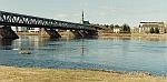 |
Bridge over the Kemi River. Cars and other vehicles travel on one level, and trains on the other. The Lutheran Church, in the background, was rebuilt in 1945, after the German Army burnt most of Lapland when it departed near the end of World War II. |
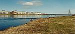 |
Rovaniemi in the background, rebuilt almost entirely after its destruction by the occupying German Army. |
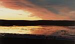 |
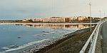
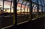
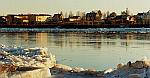
Sunset looking across the river at Rovaniemi. In mid-May, sunset is at midnight and the colorful sunsets like this last an hour or longer. |
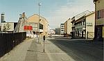 |
Rovaniemi street early on a Sunday morning in mid-May. |
 |
Another Rovaniemi street early on a Sunday morning in mid-May. |
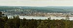 |
Rovaniemi as seen Ounasvaara Fell which is across the river, to the east of Rovaniemi. The Sky Hotel Ounasvaara is on the top, with nearby ski slopes. |
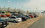 |
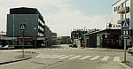
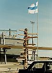
Rovaniemi
International Airport. |
 |
Mileage markers at Rovaniemi Airport. Rome: 2938 km, Madrid:3524 km, San Francisco: 8169 km,New York City: 6204 km, Bejing: 6077 km, Santa Claus Village: 18 km, Bangkok: 7797 km, Rio de Janeiro: 11594 km, Paris: 6204 km, London: 2260 km, Tokyo: 7340 km, Singapore: 9394 km, Anchorage: 5784 km, Brussels: 2158 km. |
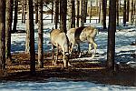 |
Reindeer are released in the spring and wander the open range of Lapland during late spring, summer and fall. |
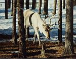 |
Reindeer in the open range of Lapland. |
 |
The entrance to the Arktikum, the new Artic Center and Lapland Provincial Museum. |
 |
Most of
the Arktikum is underground. The museum features a history of Rovaniemi,
and exhibits about the Saame culture. |
 |
A dam and hydroelectric generation plant on the river about 5 kilometers south of Rovaniemi. |
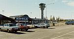 |
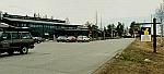
The airport at Kattilä, a city of about 6000 people. The airport and trains to this area are very busy in the winter months, as people arrive to ski on the slopes in this area. |
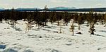 |
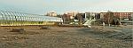
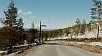
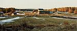
The countryside
around Kattilä in mid-May. The terrain is fairly flat, with
the distance fells (small mountains). The harsh winters keep the
everygreen trees very short. |
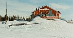 |
The coffee
shop atop Levi Fell, near Kattilä. This is mid-May, and people
still ski these slopes. |
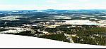 |
Looking north from Levi Fell. The town of Sirkka, population of several thousand, is at the bottom of the fell, and is located about 20 kilometers north of Kattilä. |
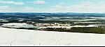 |
Looking northeast from Levi Fell. |
 |
The road to the top of Levi Fell. |
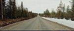 |
Back roads off of the main Highway 79, near Meltaus, which is about 60 kilometers north of Rovaniemi. |
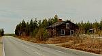 |
A deserted home near Meltaus, north of Rovaniemi. |
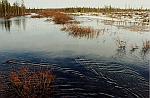 |
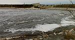
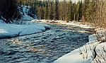
Local flooding from melting snow, near Meltaus. |
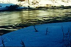 |
The Keur River in mid-May, near Yllas, which is about 150 kilometers driving distance north of Rovaniemi. |
 |
Another view of the Keu River, as snow melts in mid-May. |
 |
The Ouha River near Pello. |
 |
Looking across the Auha River from Pello, Finland to Pello, Sweden. |
 |
A farm near Pello.. |
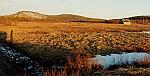 |
A hay field near Pello, with terrain typical of what is seen in Lapland. |
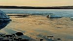 |
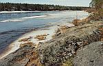
Rdanioj Lake near Pello, as the ice on the lake melts in mid-May. |
 |
Santa Claus Village which is located at approximately the location of the Artic Circle, about 15 kilometers north of Rovaniemi. The Artic Circle is not a stationary line, but moves depending on planet alignment. |